For those interested in Plot maps of Old Fair Oaks, we have a few. As always, if you have corrections or suggestions, please e-mail the webmaster.
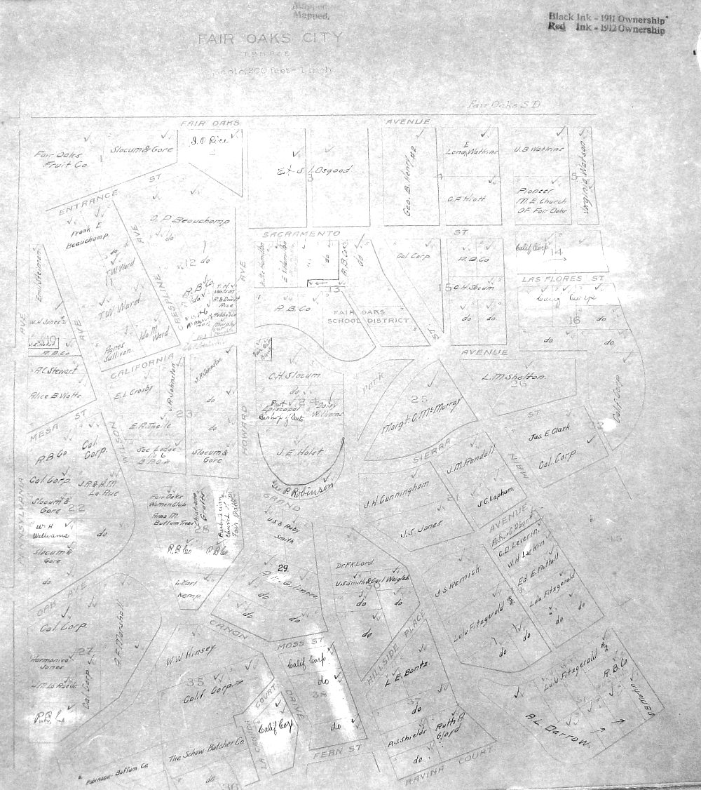
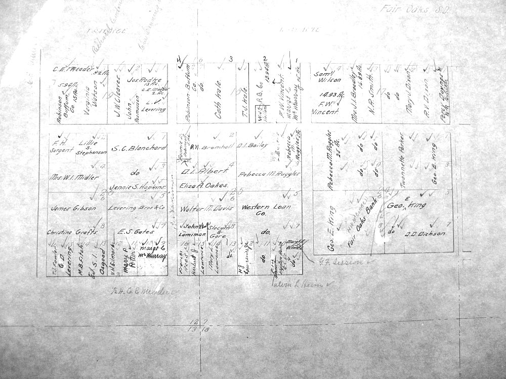
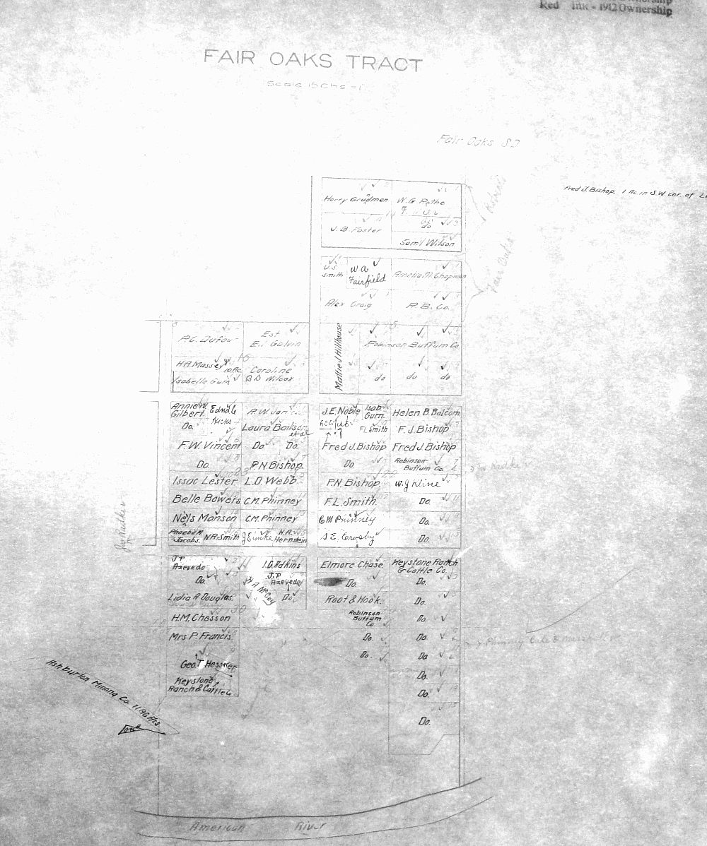
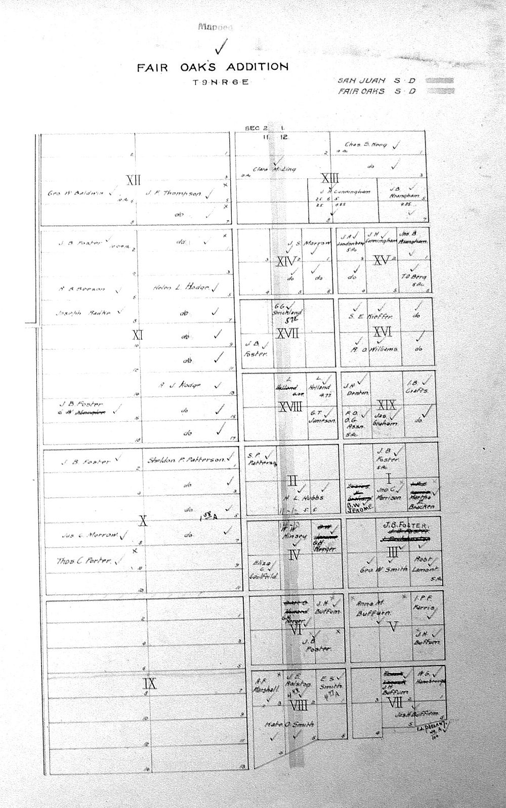
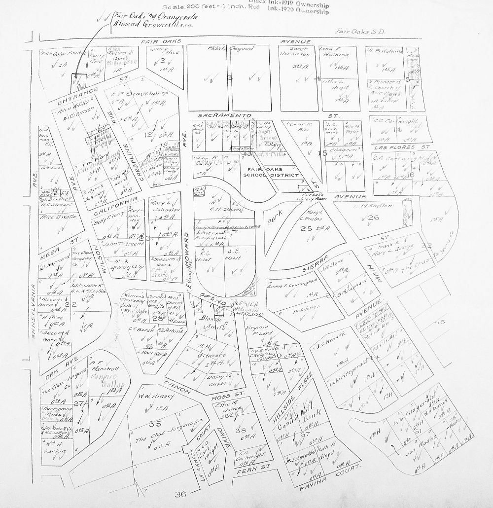
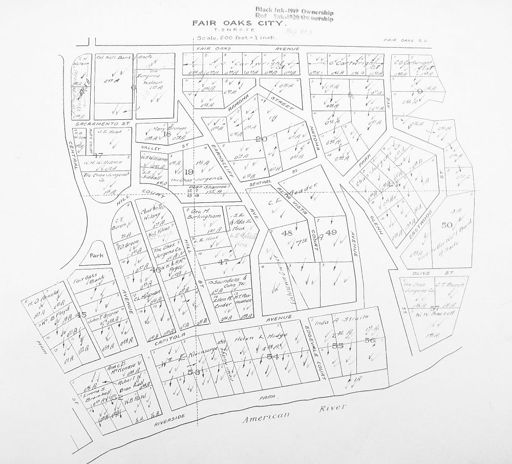
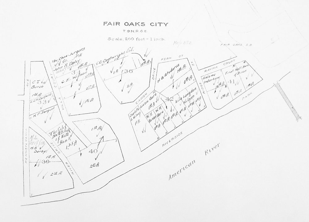
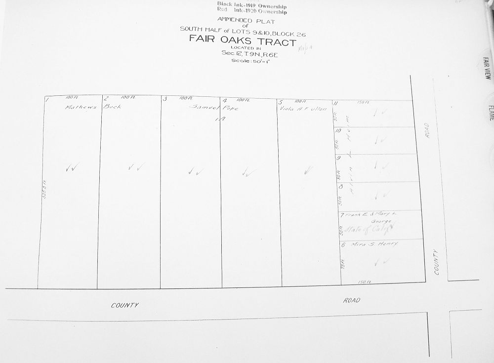
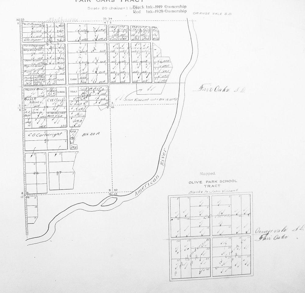
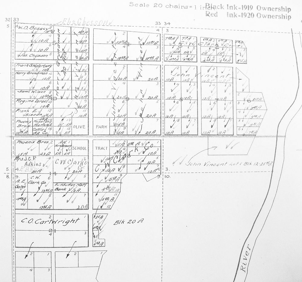
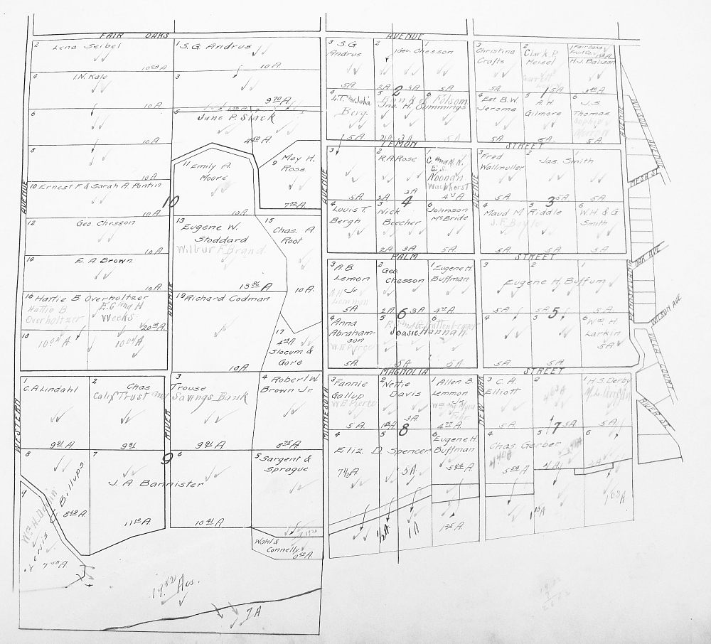
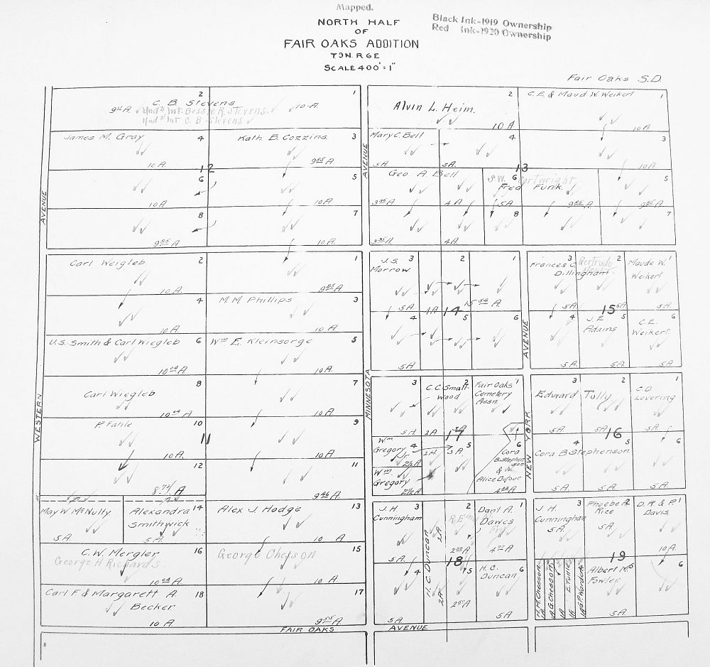
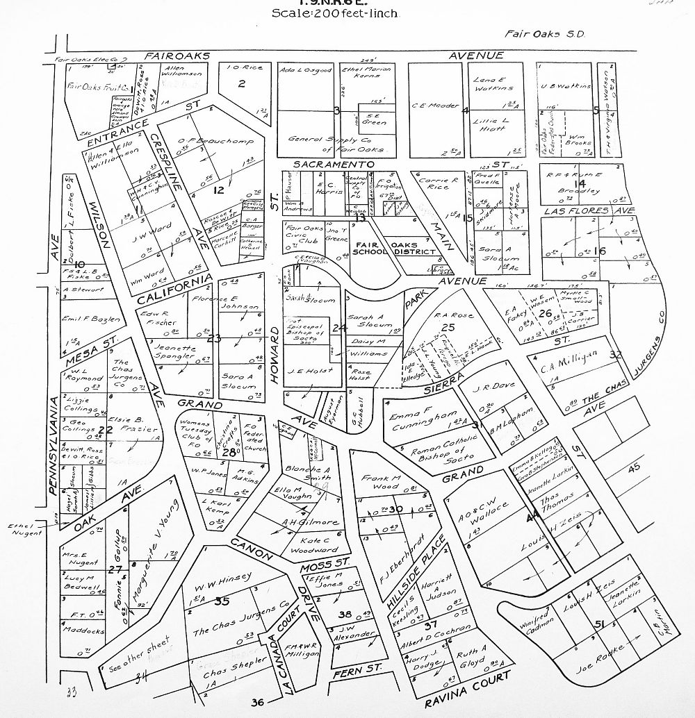
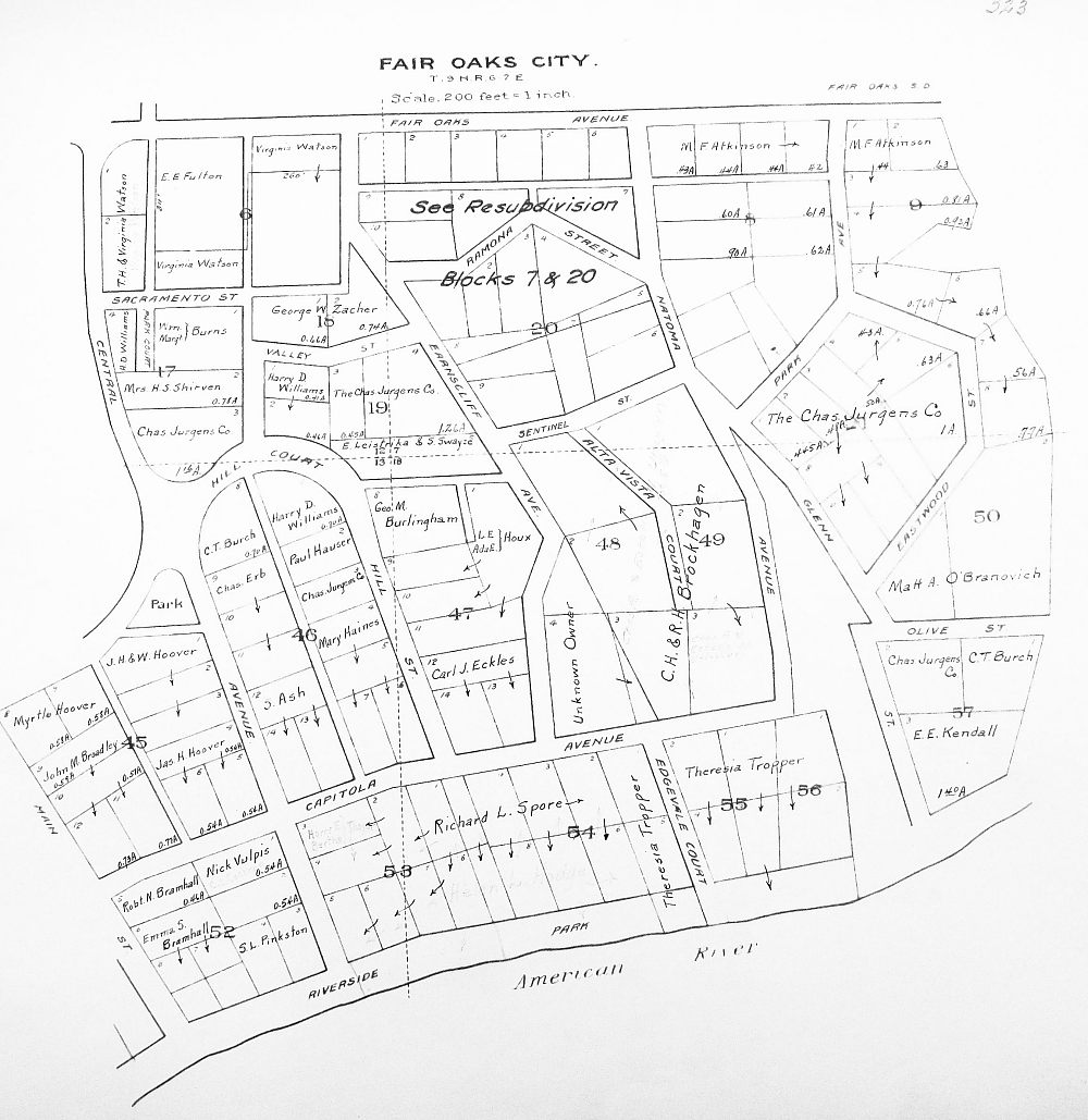
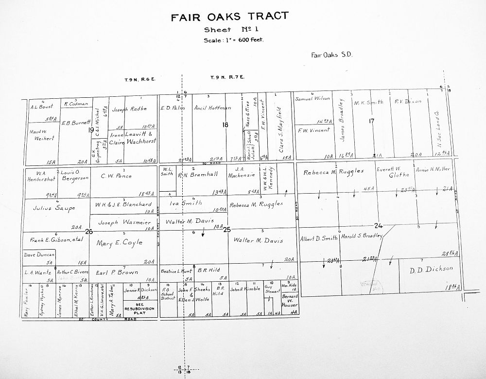
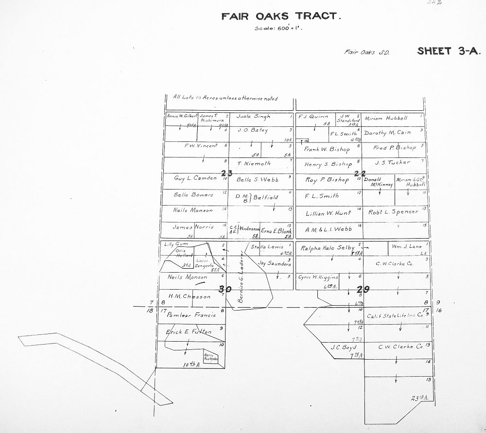
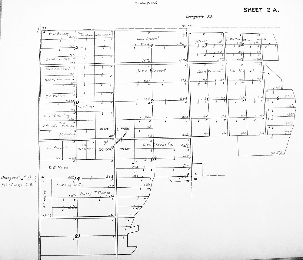
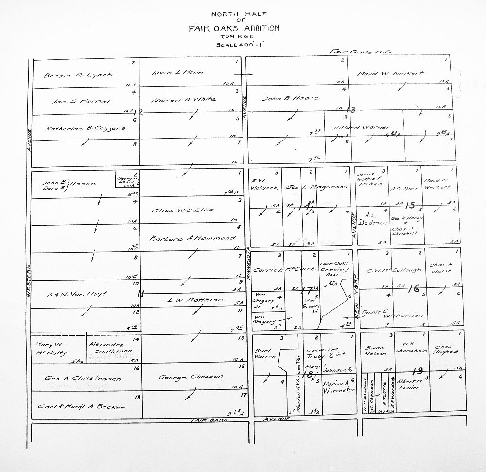
We recently (6/09) revisited the Sacramento Archives as promised, with decent equipment and lights, and photographed the Fair Oaks sections of the Sacramento County Appraiser's plot maps for 1912, 1920 and 1930. These maps show property ownership of each parcel in Fair Oaks for the particular year.
The 1920 and 30 maps were in pretty good shape, but the 1912 maps were very faded and brown. We did our best.
Be careful when interpreting the maps. They show who owned the property, not necessarily who lived there. Many families owned the property they lived on, and also owned other parcels which they leased out to less wealthy tenants. Also, it was common for a parcel to be held in the wife's name. Laws were passed in the 1800's to provide some security for a family in case of financial adversity (mainly crop failure), and property in a wife's name was insulated against creditors.
Some current areas of Fair Oaks are not included - boundaries have changed over time.
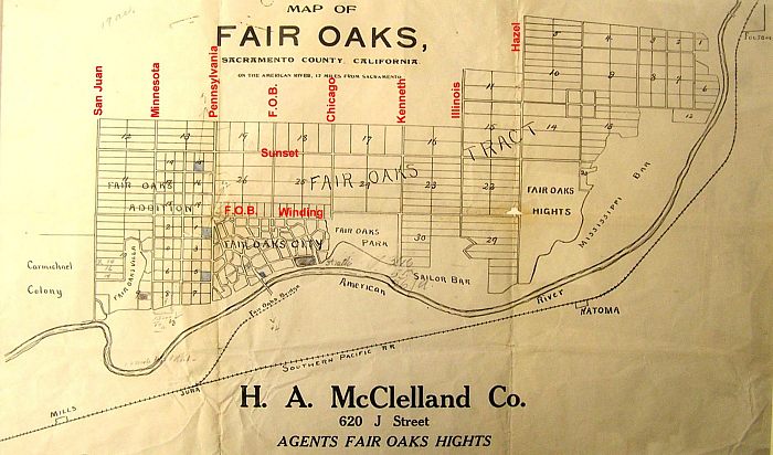
The plot maps in most cases do not include street names, but you'll recognize many of the areas. However, using a slightly modified 1910 advertising map of Fair Oaks (I added the red street names for reference) which shows the plot numbers, you can zero in on a specific area.
Note that there are several divisions of Fair Oaks, each with it's own plot numbers, starting with "1" and going up through the numbers. The areas are:
Old Town Fair Oaks Assessor's Plot Maps:
1912:
1920:
1930: