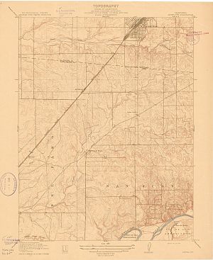
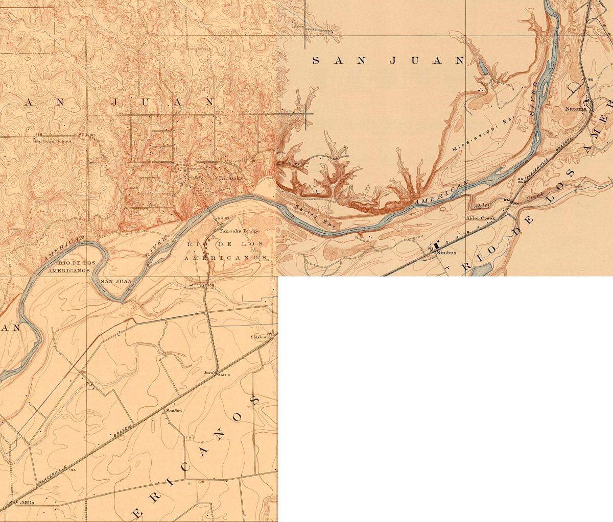
Fair Oaks Area, 1911
The U.S.G.S Series
Including parts of Folsom, Orangevale, Citrus Heights, Gold River and Carmichael
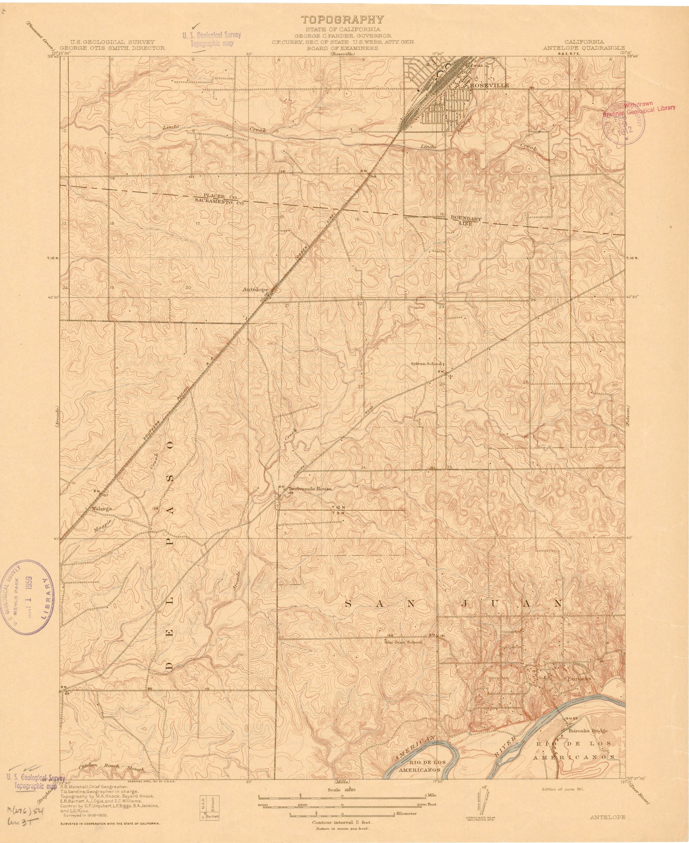
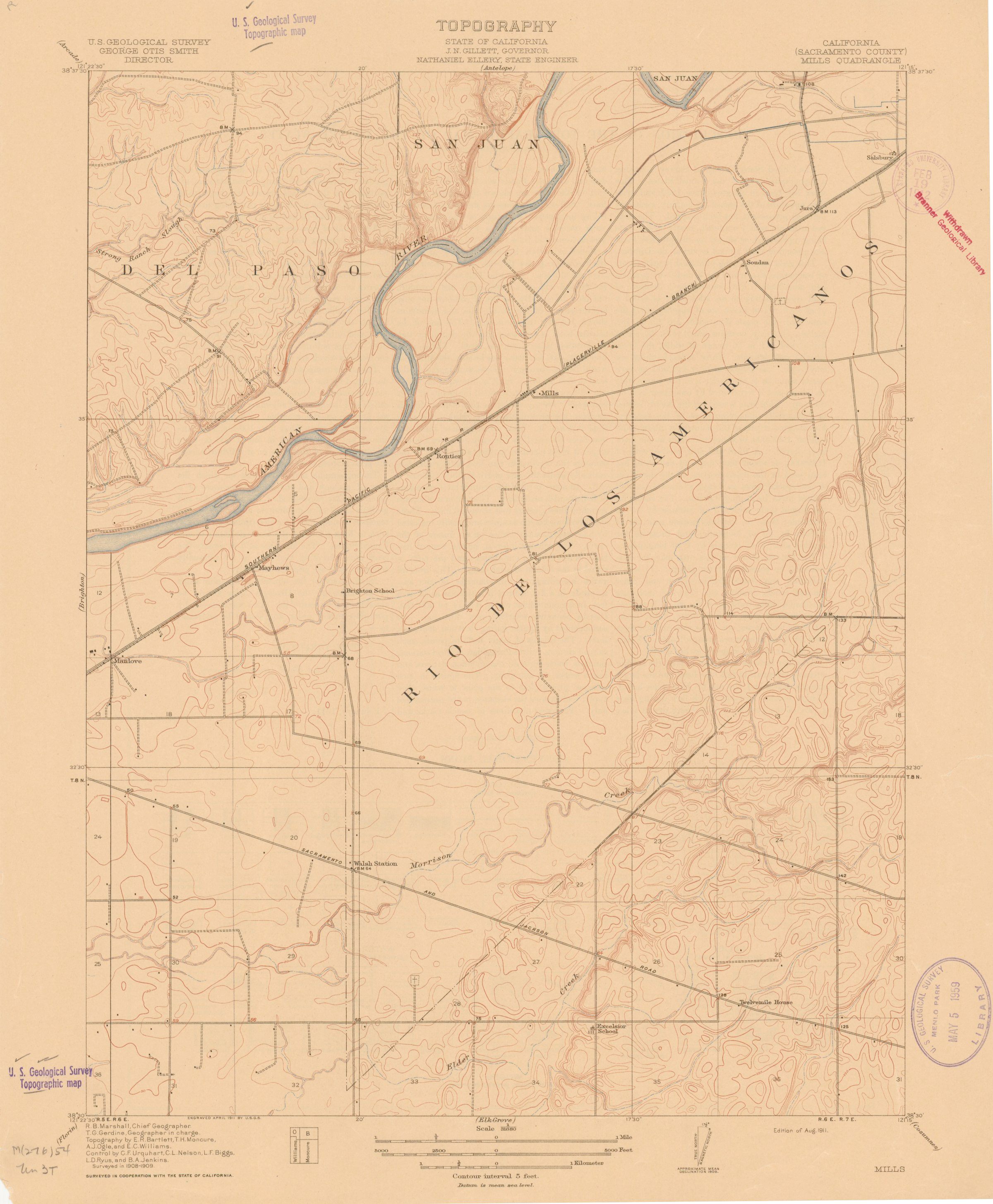
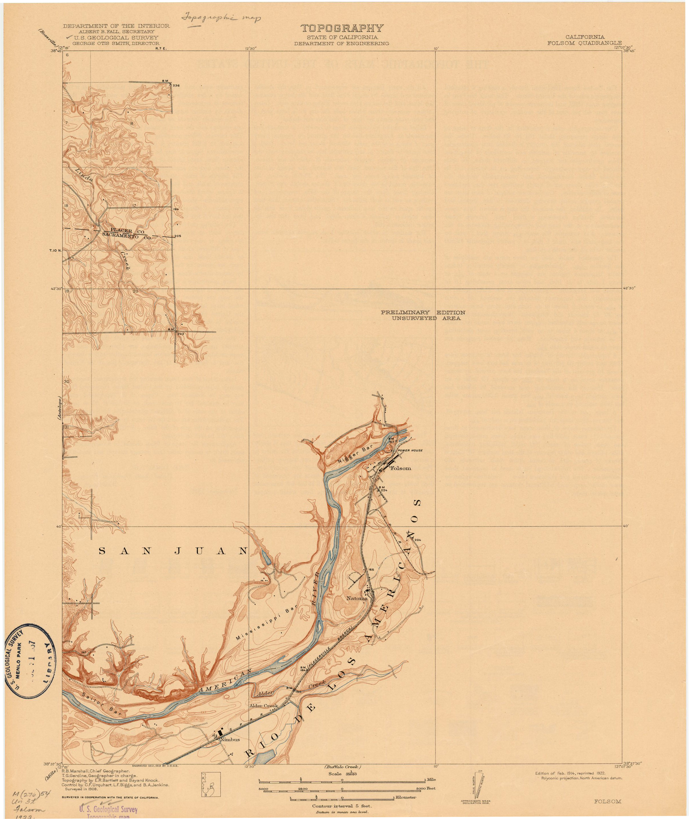
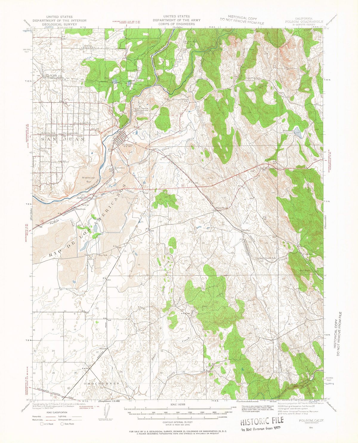
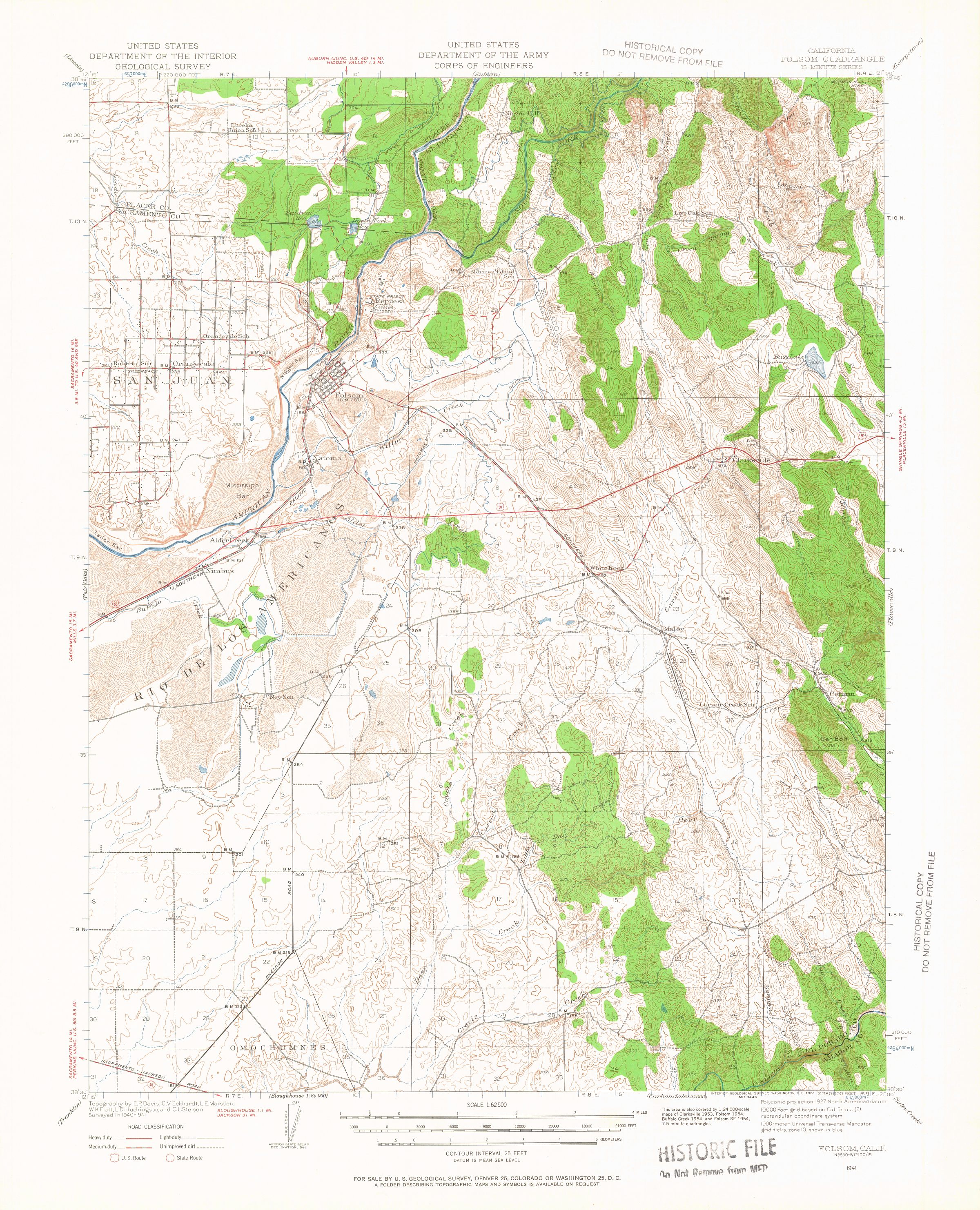
 Eastern Sacramento County was surveyed and mapped by the U. S. Geological Survey
from 1908 to 1914. There were three 15 minute quadrangles published; Antelope which
contains most of Fair Oaks, Citrus Heights and Orangevale; Mills which contains the
area south of the American River, and Folsom which shows some of eastern Fair Oaks.
We don't know why the Folsom quad was not surveyed in its entirety during this period, but this section
was not completed until 1944.
Eastern Sacramento County was surveyed and mapped by the U. S. Geological Survey
from 1908 to 1914. There were three 15 minute quadrangles published; Antelope which
contains most of Fair Oaks, Citrus Heights and Orangevale; Mills which contains the
area south of the American River, and Folsom which shows some of eastern Fair Oaks.
We don't know why the Folsom quad was not surveyed in its entirety during this period, but this section
was not completed until 1944.
These maps are important to Fair Oaks history not only because they show the
general population and roads of the area, but because they also show the structures
that existed when the maps were drawn. That information is extremely useful in
researching early homes and other structures of the area.
For example, old residents have heard of a school somewhere out in the
San Juan Avenue-Winding Way area but are confused if it actually existed. The
Antelope map clearly shows the San Juan School located just across San Juan
Avenue from the old Dewey home.
Another example is what we'll call Fair Oaks Lake. In his Memories article, Grant
Wallace remembers a lake out on the Bald Spot (later Phoenix Field airport) where early Fair
Oaks residents went to have Fourth of July picnics and other weekend outings. He
tried to locate the spot in the 1950's, but was only marginally successful. Now, from the Folsom
quad map, we can clearly see the lake's location in the Winding Oak area.
We'll link to the maps below, and since the Folsom quad was only partially done
in the 1911 series, we'll include the 1944 map of that area. Eastern Fair Oaks was
still only lightly populated at that time. We'll also link to a
composite map we put together to make it easier to see the
whole picture. It should be noted that the availability of these maps is partially
due to the diligence of FOHS members in convincing the USGS office in Menlo
Park to digitize their 1911 California Central Valley Series maps and provide the
images on CD to the public.
We'll also update the website generally to reflect our error in naming the Fair Oaks
topographic map used in mapping houses as a 1908 map. While the map was
originally done in 1908, the map used in the website was an updated version done
in 1911 and showing structures that existed then.
As always, any questions or comments should be directed to the Webmaster.
Return to the FOHS home
page.