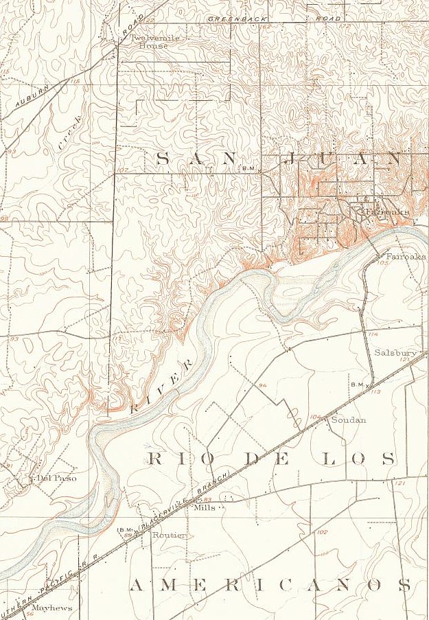
Like the Orangevale Colony, the Fair Oaks Colony didn't exactly materialize as quickly as planned. This partial 1902 updated USGS map shows the actual roads and features that existed in 1901 when the survey was done. Again, USGS maps were surveyed and accurate, and contained none of the imaginary features that the developer's maps showed. The full source map is at the US Geological Survey website.
This update is significant because it shows the new rail spur to the Fair Oaks station and the newly constructed Fair Oaks Bridge. Winding Way is now completed through its somewhat circuitous route to Fair Oaks, and the beginnings of western Fair Oaks can be seen (Minnesota, Bannister, Pennsylvania, New York). The Fair Oaks to Sacramento road is now recognized for what it was, a dotted line and sometimes unpassable. But, much of Fair Oaks is starting to take shape. The east-west street running through the word "JUAN" is Sunset Avenue, but there are no north-south streets yet above Sunset - just dirt roads. The black dots on the map represent buildings, and as you can see there weren't a lot of them around Fair Oaks.