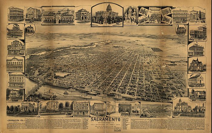
This beautiful lithograph is quite large, and can be seen in all it's glory at the National Archives website. You'll need the MrSid add-on to view the larger picture of the lithograph. Their link directly to the map does not work consistently, so go from this link to the Sacramento link and then choose the "189?" map.
Of interest to us is the area in the top left of the lithograph which we'll blow up for you below. You can see the American River winding its way up to Folsom, and along the way you'll pass the planned "Sunset Colony" of Orangevale. It, like Fair Oaks, was laid out on maps years before it actually existed. Orangevale Colony preceeded Fair Oaks by about ten years, and development and sales began in the late 1880's.
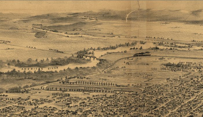
You can also see the town of Natoma on this map. Salisbury and Alder Creek were probably considered just train stations and not shown. The town of Natoma was located just north of the current Folsom Boulevard and east of current Hazel Avenue. You'll know it as the Nimbus winery where the Spaghetti Factory and Garbo's Theater are now located. More on Orangevale